- Connect SoCal
- Inclusion, Diversity, Equity & Awareness
- Programs & Projects
- Housing
- Economy & Demography
- Federal & State Compliance
- Sustainable Development and Resilient Communities
- Transportation
- Active Transportation
- Planning For Main Streets
- Aviation Program
- Regional Pilot Initiatives Program
- Future Communities Pilot Program
- Transportation Demand Management
- Transit Program
- FreightWorks
- Passenger Rail Program
- Corridor Planning
- Transportation Safety
- Transportation Finance
- Intelligent Transportation Systems
- Southern California Transportation Study
- LA28 Games Mobility Program
- Local Resources
- Funding & Programming
- Legislation & Advocacy
- Publications & Reports
Sustainable Development and Resilient Communities
Sustainability and resilience intersect multiple areas of SCAG’s regional planning work, including land use, transportation, housing, and economic development. Agency efforts across each of these issue areas achieve broader sustainability goals from the Connect SoCal Regional Transportation Plan/Sustainable Communities Strategy, such as reducing greenhouse gas emissions. This section focuses primarily on SCAG’s sustainable and resilient development initiatives related to land use, natural hazards, and climate change.
Drought, extreme heat, wildfires, earthquakes, and other natural threats have been a reality for the SCAG region and California throughout history. The accelerating frequency of these events challenges Southern California’s overall resilience and ability to adapt. Effective emergency response to large wildfires, for example, requires enhanced coordination between multiple agencies and local jurisdictions. Climate change also negatively affects air quality, drives sea-level rise and coastal and inland flooding, stresses our infrastructure and utility systems, and strains our water supply, among other impacts. These are regional issues that require local and regional coordination. SCAG’s Connect SoCal Regional Transportation/Sustainable Communities Strategy identifies a vision and strategies to guide the region to meet the demand for key needs such as housing while increasing regional resilience.
SCAG supports local and regional climate adaptation and overall resilience through a range of programs, projects, and initiatives. The following areas provide details on efforts focused more directly on land use that provide local stakeholders with best practices, policies, data and research, funding, and related information.
Contact us to learn more about Adaptation and Resilience.
- Regional Resilience Toolkit
- Water Resolution White Paper
- Natural & Agricultural Lands Economic and Resilience Benefits Study
- Southern California Climate Adaptation Planning Guide
- Climate Resilient Urban Greening Best Practices
Natural & Agricultural Lands Economic and Resilience Benefits Study
Natural and agricultural lands play an important role in local and regional resilience. Many of these lands are critical in cleaning and storing water, reducing the risks from wildfires, flooding, extreme heat, and other related threats, improving air quality, and storing carbon in soils, trees, and plants. There is often a significant gap in knowledge about the importance of these ecosystem services for resilience and a strong economy. To address this gap, SCAG has initiated the “Natural & Agricultural Lands Economic and Resilience Benefits Study.”
Funded by a Sustainable Agricultural Lands Conservation Program planning grant from the California Strategic Growth Council and the California Department of Conservation, the study will evaluate the range of economic and resilience benefits of different types of natural and agricultural lands. The study will also explore funding strategies and approaches to preserve, enhance, restore, and maintain natural and agricultural lands that provide key economic and resilience benefits.
Farmworker housing will also be explored as a stand-alone study, including an evaluation of existing farmworker housing stock and proximity to workplaces, as well as identification of funding opportunities to increase farmworker housing affordability.
Timeline*
- Spring 2025: Project Kickoff
- Spring 2025 – Summer 2026: Research and Technical Analysis
- Summer 2026 – Spring 2027: Develop White Paper and Resource Appendix
- Summer 2027: Release of final White Paper and Resource Appendix; Webinars and Training
* Timeline subject to change
Regional Resilience Toolkit
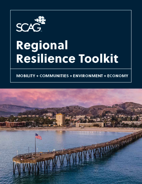
The SCAG Regional Resilience Toolkit, published in March 2026, shares resources and information to support Southern California communities, cities, and counties with resilience planning. The toolkit is intended for use by any jurisdiction in Southern California, regardless of size, population, experience in resilience planning, or direct encounters with the shocks and stressors of the current age.
The toolkit helps local jurisdictions:
- Understand the benefits of local and regional resilience planning.
- Plan for resilience at multiple scales, from integrating it into existing plans and programs to developing a standalone plan.
- Clearly outline key resilience planning steps.
- Identify and pursue funding resources and strategies.
Download the SCAG Regional Resiliance Toolkit
Download the SCAG Regional Resilience Toolkit factsheet.
SCAG developed the Regional Resilience Toolkit as part of the Regional Resilience Framework included in Connect SoCal 2020 Regional Transportation Plan/Sustainable Communities Strategy policy priorities and the SCAG Regional Council's Resolution No. 21-628-1 on climate change action. SCAG developed the Regional Resilience Framework with funding through the Regional Resiliency Analysis process created by Senate Bill 1 (Atkins, 2021).
The toolkit also supports implementation of Connect SoCal 2024's vision for a more sustainable and resilient region.
Southern California Climate Adaptation Planning Guide
The "Southern California Climate Adaptation Planning Guide” is a resource to assist local and regional jurisdictions in adapting to climate change. It provides an overview of how the Southern California region can work together to plan and prepare for the impacts of sea- level rise, extreme heat, increasingly frequent and damaging wildfires, and other climate-related issues. The planning guide includes a collection of appendices to support local implementation, including:
- General Plan and Local Coastal Plan Model Policies.
- Indicators and Performance Metrics for local and regional projects, processes, and outcomes.
- A Matrix of Adaptation Strategies and Actions linked to various climate hazards.
- SB 379 Guidebook to assist jurisdictions in the update of general plan safety elements for compliance with state law.
These resources are tailored to the region and outline a general process of adaptation planning that can be applied by any agency—no matter where they fall across the spectrums of funding, available resources, knowledge of vulnerabilities, and planning sophistication. SCAG worked with local municipalities, advocacy groups, universities, and other stakeholders to assess the unique issues affecting the SCAG region, available planning tools and resources, scientific data, and messaging strategies. Many local jurisdictions do not have the resources to adequately assess their local hazards, develop effective adaptation plans, and participate in regional planning efforts. This resource provides an adaptation roadmap to help build a more resilient Southern California.
The project was funded by the Caltrans Adaptation Planning grant program.
Water Resolution White Paper
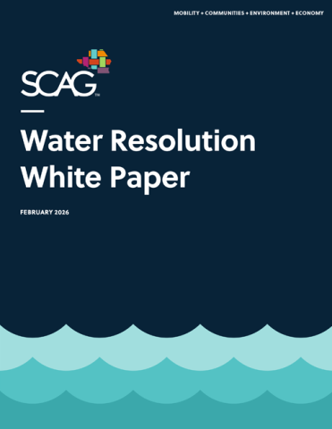
SCAG published the “Water Resolution White Paper” in March 2026 to evaluate shared water management challenges and identify opportunities for stronger coordination, investment, and technical support across jurisdictions.
SCAG developed the white paper in response to the Water Action Resolution, adopted by the Regional Council in October 2022, which called for regional collaboration to address regional water resilience challenges.
The white paper explains how collaborative resilience planning at the local level can achieve regional benefits to protect Southern Californians now and in the future.
Climate Resilient Urban Greening Best Practices
The changing climate will impact Southern California in several ways, including more days with extreme heat, rising sea levels, more frequent wildfires and shifting precipitation rates. With this reality, urban greening, and urban trees in particular, can play a key role in improving community health, mobility, and overall quality of life, and achieving greenhouse gas emissions goals. SCAG outlines urban greening as the greening of developed areas within Southern California communities that can benefit from cooling strategies to reduce urban heat island effects and extreme heat.
Health Benefits and Urban Heat Reduction
Urban greening is an important tool to improve resiliency and equity in a changing climate. Urban greening is especially important in low-income communities where residents are more likely to depend on walking or biking to access public transportation and reach key destinations such as jobs, schools, healthcare and shopping but often lack trees that can lower urban heat. Urban trees are shown to reduce air pollution, improve water quality and boost mental health through lowered stress levels. They have also been shown to mitigate existing heat conditions by providing shade and lower temperatures making it more comfortable to walk or bike which leads to better health outcomes and lowered Vehicle Miles Traveled (VMT).
Resilience and Greenhouse Gas Emissions Benefits
Trees have a variety of resilience and greenhouse gas (GHG) emissions benefits, including:
Reduce stormwater runoff: Street trees support cleaner water by increasing the capture of urban runoff from rainfall. This rainfall would otherwise enter waterways such as the ocean, rivers and streams carrying pollutants that are unhealthy to plants, animals, and people.
Replenish groundwater: Tree roots increase the ability of soil to absorb rainwater, creating an estimated annual savings of $4.55 per tree in groundwater replenishment.
Reduce electricity use: Urban trees reduce overall electricity usage. It’s estimated that annual electricity savings from reductions in air conditioning use through urban heat mitigation can be equivalent to the amount of energy required to air condition over 210,000 households each year, translating to $11.08 annually per tree.
Reduce GHGs: Approximately 7.78 million tons of carbon dioxide are stored in California’s 9.1 million street trees. California street trees remove and avoid 567,748 tons of CO2 emissions annually, equivalent to removing 120,000 cars from the road.
Reduce VMT: Street trees improve comfort for people who walk, bike or roll making it easier to choose more sustainable modes of transportation.
With extreme heat projected to become more frequent and severe due to climate change, communities should prioritize tree planting and other strategies that reduce urban heat islands.
Urban Forestry Best Practices
Urban forestry programs should practice the right tree, right place rule. Planning for the right tree that will thrive in its location, combined with a plan for continuing care, is crucial for the tree to grow to full maturity. Without early planning and tree care implementation, trees are likely to have high mortality rates, undercutting the ability of tree-planting programs to provide the full range of potential community benefits. Giving trees the best chance of success includes the following recommendations:
- Conduct a site-specific evaluation
A site-specific evaluation can determine whether a particular tree is well suited to be planted in an area, the benefits that can be expected from this tree and whether it will be at risk for early removal. This evaluation should include checking to see if there are risks to infrastructure, such as underground or overhead utilities and sidewalks, that could result from a particular tree. Jurisdictions can partner with community organizations that provide ecological consultation to determine the expected benefits and plans of action for tree planting programs.
- Provide adequate soil
Trees that are planted in sites with sufficient soil volume will grow faster, develop larger canopies and outlive those grown in smaller volumes. The recommended soil volume for a healthy street tree is 600 cubic feet for a small tree (20-30 feet), 900 cubic feet for a medium tree (30-60 feet) and 1200 cubic feet for a large tree (60+ feet).
- Plan for tree care in the first 10 years
Mature, healthy trees provide more benefits than younger trees. Long-term tree maintenance is crucial for tree survival and growth. Many tree planting programs have high mortality rates due to a lack of long-term, planned care. Once planted, street trees are often left to survive by precipitation alone.
- Effective tree care includes:
- Planned irrigation: The overseeing organization should develop a plan for appropriate, continuous irrigation rather than relying only on precipitation.
- Adding mulch: As temperatures rise and communities become dryer, adding wood-chip mulch will keep the soil temperature cooler, thereby preserving warmth for the roots, hold moisture for longer and prevent weeds from growing.
- Prevention of early tree removal: Planting programs should coordinate with appropriate stakeholders to ensure that planted trees will not be removed prematurely.
- Effective pruning: Trees should be pruned by a certified arborist. Pruning should occur once a year and consists mainly of the removal of diseased or dead branches or causing a threat to public safety. Trimming throughout the year may be needed to remove branches along travel corridors. Arborists can refer to the ANSI A300 Pruning Standards and companion “Best Management Practices – Tree Pruning” for acceptable practices.
- Effective tree care includes:
- Select the right species
Species selection has been shown to have a large impact on tree survival rates, even before changes environmental changes due to climate change. With projected changes in multiple factors such as air temperature, wind, and precipitation, that will affect tree survival rates by mid to end-of-century, communities should consider creating a list of trees that can withstand future environmental conditions.
- Ensure a diverse urban forest
Species diversity is important to protect the urban forest against catastrophic failure caused by a species- or genus-specific pathogen or disease.
- Engage and collaborate with local communities
Engagement with local communities where tree planting programs take place is crucial to the success of the program. Tree planting programs that target private planting should incentivize and educate about maintenance challenges, and identify the appropriate trees. Dig sites on public lands have failed due to a lack of engagement with residents or a lack of long-term tree maintenance from the municipality. Communities should consider using volunteers, with clear guidance and supervision to reduce the costs of tree planting programs.
- Plan for post-planning monitoring and evaluation
A plan for post-planning monitoring and evaluation can help to evaluate the effectiveness of tree-planting programs.
- Resources for urban forestry best practices
City Tree Ordinances
Because of the immense value of planting and caring for trees, communities should consider implementing tree ordinances that establish clear guidelines and regulations for the maintenance and removal of trees on public and private lands. Comprehensive tree preservation ordinances can play a central role in successfully protecting trees during and after residential development.
- SCAG Region Urban Greening Management Plan Examples
- Resources for creating a Tree Ordinance
Identifying Priority Areas for Tree Planting
Urban forestry programs can be used as one of the strategies to improve health, environmental and heat reduction outcomes in underresourced communities. which often lack parks and open spaces. The following resources may help you determine which areas to prioritize tree planting.
- Resources to consider when prioritizing areas for tree planting
- The USDA Forest Service Tree Canopy Data: This map overlays tree canopy coverage data at 60-cm spatial resolution, ozone and PM 2.5 pollution information, CalEPA’s urban heat island index, and other public health indicators. This map shows which areas lack tree canopy coverage, combined with low health indicators, to prioritize areas for tree planting.
- Multi-Resolution Land Characteristics (MRLC) Consortium: This resource provides land cover datasets at the national scale.
- California Healthy Places Index: This map shows data on social conditions that drive health such as education, economic opportunities, clean air and water, and other indicators.
- California Healthy Places Index: Extreme Heat Edition: This resource shows the number of days above 90 or 100 degrees at various time scales such as mid- and end-of-century down to cities and elementary school districts. It also shows other indicators such as tree canopy coverage (from the national land cover database), park acres, impervious surface cover, urban heat island index, PM 2.5, Diesel PM, ozone and more.
Tree Planting in a Changing Climate
Climate change is projected to cause changes in air temperatures, precipitation, disease frequencies and other factors that will affect the ability of trees in urban and natural forests to survive. The interactions of drought, heat stress and insect outbreaks due to climate change, as well as other factors, can lead to forest mortality in complex patterns. Drought-related tree mortality may even occur years or decades after the drought. Different sequences of climate events, such as a flood followed by a drought, can also affect tree growth and the risk of mortality.
Selecting trees that are appropriate for the site and able to withstand a variety of landscape characteristics will be key in planting resilient, climate-ready urban forests. Communities should consider forming a tree list that includes a variety of different tree species that show promise in withstanding the local projected climate hazards. Please note that research into climate-ready trees is still in its early stages and there are information gaps on how climate change will impact tree survival rates. Here are the factors to consider when forming your tree list. Communities should determine priority based on their projected climate hazards.
- Consider plants that have low water requirements or are drought tolerant
Planting programs may want to prioritize trees that use low amounts of water because climate models predict that drought and heat waves will increase water loss from tree surfaces (evaporative demands).
- Consider plants that can tolerate multiple water levels or soil moisture levels
In some regions, flooding will be an increased risk within this century. Selecting trees that have been known to be tolerant to multiple water levels may increase their ability to survive in projected flood-prone areas. There is limited information on tree species’ levels of tolerance to water levels. Communities should consider working with local arborists to identify trees that can tolerate high water levels if increased flooding is projected.
- Identify trees that can do well in new projected USDA hardiness zones
Select trees that can potentially do well in the projected future U.S. Department of Agriculture (USDA) Plant Hardiness Zones, minimum and maximum temperatures.
- Identify trees that can do well in new projected air temperature
Warmer temperatures alone can increase forest water stress independent of precipitation amount and can accelerate drought-induced mortality. Selecting species that have been known to thrive in multiple temperatures can potentially increase their chances of survival in a rapidly changing climate.
- Select trees with more tolerance for salinity levels
The SCAG region has been increasingly using recycled water, which tends to have higher salinity due to the water treatment process. Selecting species that have higher salinity tolerance may increase these trees’ chances of survival.
- Consider pest resilience in the tree palette
Climate change is projected to induce uncertain changes to pest environments. Due to warmer climates, some communities may experience new and longer pest seasons. Diverse species will decrease the chances that an urban forest made up of a singular species will be wiped out due to pests targeting that species.
- Consider native trees that can thrive and support biodiversity
Species diversity should be an important factor for communities when forming tree lists to account for both the need for the urban forest to provide habitat for native species and climate resiliency.
- Create a plan for managing non-native and invasive species
Non-native plants are species that have not historically lived in one area but have been introduced by humans. Invasive species are also non-native but their introduction causes harm to the surrounding ecosystem. Communities should avoid the use of known invasive species and undertake continuous monitoring to ensure that any non-native species that are introduced do not cause harm to the local ecosystem. There is no source of information that comprehensively identifies which species will be invasive in a local area. Communities should utilize the best available resources and work with local arborists to select trees that have not been known to be invasive and plan for continuous monitoring.
Resources for Creating a Tree List
- Projected risk factors and future climate
Risk Factor: This tool by the First Street Foundation allows you to see the projected risk factors of your city, including flood, extreme heat, fire and wind factors.
Cal-Adapt: Cal-Adapt allows you to see projected mid-century (2035-2064) and end-century (2070-2099) annual average maximum and minimum temperatures, and annual average precipitation, broken down by cities, counties, congressional districts and other boundaries.
Climate Assessment Tool: This tool allows you to see how suitable certain taxa, or groups of trees are to the future climate of a botanic garden’s location or by longitude and latitude coordinates. Not all species of plants and botanical gardens are included. The analysis of the climate suitability of species is based on mean annual temperature.
Future Plant USDA Hardiness Zone: This interactive web tool by Davey Institute and Arbor Day Foundation allows you to see the projected new USDA Hardiness Zone of your area based on multiple emissions scenarios.
USDA Hardiness Zone Map: The USDA Hardiness Zone Map allows you to identify your current USDA hardiness zone based on zip code. The map is based on the average annual minimum winter temperature. Although plants are often noted to show that they can live in certain USDA zones. A plant may still thrive in an area not indicated to match its USDA zone.
- Tree characteristics
Climate Ready Trees: Climate Ready Trees is a resource compiled by a coalition of university, USDA forest service researchers, and ecological non-profits that highlights a number of trees that may be particularly suited to tolerate the stressors of a changing climate.
SelecTree: SelecTree allows you to search California trees by tree characteristics such as whether they are native, height, tree shape, salinity tolerance, water use rating, sun exposure and landscape information such as USDA hardiness zone, sunset climate zone, utility precautions, available planting size, and more.
The Water Use Classification of Landscape Species: This database by the UC Davis California Center for Urban Horticulture assigns ratings for irrigation needs from very low to high.
CalScape: This resource by the California Native Plant Society can help you identify where, on a map, different native species are found in California. This resource also provides basic information about plant characteristics and how to care for them.
Waterwise Garden Planner: This tool allows you to search for different California plants based on whether they’re native, plant type (trees or shrubs), evergreen or deciduous, water needs, sun exposure, aesthetics and functions.
- Where trees historically lived and invasiveness
CalScape: This resource by the California Native Plant Society can help you identify where, on a map, different native species are found in California. This resource also provides basic information about plant characteristics and how to care for them.
Inventory of Invasive Plants: This list by the California Invasive Plant Council ranks the invasiveness of species.
- Guides on how to create your tree palette
California Tree Palette for Schoolyard Forests: This resource by the Green Schoolyards of America is intended to help you identify trees that are climate-resilient and are appropriate for a schoolyard setting by sunset climate zones in California.
Planning for resilient urban forests: A datadriven approach to assessing urban tree species suitability in California: This presentation by Natalie Love, Ph.D. describes a process by which communities can use to select a tree list for their city.
Climate Change and Urban Forests: This presentation by Igor Lacan, UC Agriculture and Natural Resources, (UCANR) describes the space-for-time substitution process that can be used to identify tree species for a community’s future climate.
Tree Species Selection Guidelines for the Albuquerque Metro Area: A study on identifying climate-ready trees by the Nature Conservancy for the Albuquerque area.
- List of locally specific climate-resilient trees considered by other organizations
California Tree Palette for Schoolyard Forests: This resource by the Green Schoolyards of America is intended to help identify trees that are climate-resilient and are appropriate for a schoolyard setting by sunset climate zones in California.
Planting Resilience: Identifying Climate-Resilient Tree Species and Increasing Their Presence in Los Angeles’ Urban Forest: This study by the UCLA Luskin School of Public Affairs and TreePeople identified 28 climate-resilient tree species that show promise for Los Angeles County.
Climate Ready Trees: Climate Ready Trees is a resource compiled by a coalition of university, USDA forest service researchers, and ecological non-profits that highlights a number of trees that may be particularly suited to tolerate the stressors of a changing climate.
Tree Species Selection Guidelines for the Albuquerque Metro Area: A study on identifying climate-ready trees by the Nature Conservancy for the Albuquerque area.
References
- Adams, H. D., Guardiola-Claramonte, M., Barron-Gafford, G. A., Villegas, J. C., Breshears, D. D., Zou, C. B., … & Huxman, T. E. (2009). Temperature sensitivity of drought-induced tree mortality portends increased regional die-off under global-change-type drought. Proceedings of the national academy of sciences, 106(17), 7063-7066.
- Allen, C. D., Macalady, A. K., Chenchouni, H., Bachelet, D., McDowell, N., Vennetier, M., … & Cobb, N. (2010). A global overview of drought and heat-induced tree mortality reveals emerging climate change risks for forests. Forest ecology and management, 259(4), 660-684.
- Ball, J., Mason, S., Kiesz, A., McCormick, D., & Brown, C. (2007). Assessing the hazard of emerald ash borer and other exotic stressors to community forests. Arboriculture and Urban Forestry, 33(5), 350.
- Bigler, C., Gavin, D. G., Gunning, C., & Veblen, T. T. (2007). Drought induces lagged tree mortality in a subalpine forest in the Rocky Mountains. Oikos, 116(12), 1983-1994.; Pedersen, B. S. (1998). Modeling tree mortality in response to short-and long-term environmental stresses. Ecological modelling, 105(2-3), 347-351.
- City of Long Beach, & Alta Planning + Design. (2021). Cooling Long Beach Urban Heat Island Reductions Strategies. City of Long Beach.
- Lacan, I. (2023). Climate Change and Urban Forests.
- Lohr, V. I., Kendal, D., & Dobbs, C. (2014, August). Urban trees worldwide have low species and genetic diversity, posing high risks of tree loss as stresses from climate change increase. In XXIX International Horticultural Congress on Horticulture: Sustaining Lives, Livelihoods and Landscapes (IHC2014): V 1108 (pp. 263-270).
- McPherson, E. G., Berry, A. M., & van Doorn, N. S. (2018). Performance testing to identify climate-ready trees. Urban Forestry & Urban Greening, 29, 28-39.
- McPherson, E. G., van Doorn, N., & de Goede, J. (2016). Structure, function and value of street trees in California, USA. Urban forestry & urban greening, 17, 104-115.
- Miao, S., Zou, C. B., & Breshears, D. D. (2009). Vegetation responses to extreme hydrological events: sequence matters. The American Naturalist, 173(1), 113-118.
- Ndugga, N. and Samantha Artia. Extreme Heat and Racial Health Equity. Kaiser Family Foundation. Accessed at https://www.kff.org/policy-watch/extreme-heat-racial-health-equity/.
- Pike, K., O’Herrin, K., Klimas, C., & Vogt, J. (2021). Tree preservation during construction: An evaluation of a comprehensive municipal tree ordinance. Urban Forestry & Urban Greening, 57, 126914.
- Pincetl, S. (2010). Implementing municipal tree planting: Los Angeles million-tree initiative. Environmental management, 45(2), 227-238.
- Rosenfeld, A., & Waugh, B. (2019, January 7). Why People Reject City Trees. The University of Vermont; The University of Vermont. https://www.uvm.edu/news/gund/why-people-reject-city-trees
- Schneider, R. J. (2011). Understanding sustainable transportation choices: Shifting routine automobile travel to walking and bicycling. University of California, Berkeley.
- Song, X. P., Tan, P. Y., Edwards, P., & Richards, D. (2018). The economic benefits and costs of trees in urban forest stewardship: A systematic review. Urban Forestry & Urban Greening, 29, 162-170.; Vogt, J., Hauer, R. J., & Fischer, B. C. (2015). The costs of maintaining and not maintaining the urban forest: A review of the urban forestry and arboriculture literature. Arboriculture & Urban Forestry, 41(6), 293-323
- Vibrant Cities Lab : Resources for Urban Forestry, Trees, and Green Infrastructure. (n.d.). Www.vibrantcitieslab.com; Vibrant Cities Lab. Retrieved May 15, 2023, from https://www.vibrantcitieslab.com
- Wattenhofer, D. J., & Johnson, G. R. (2021). Understanding why young urban trees die can improve future success. Urban Forestry & Urban Greening, 64, 127247.
- Widney, S., Fischer, B. C., & Vogt, J. (2016). Tree mortality undercuts ability of tree-planting programs to provide benefits: results of a three-city study. Forests, 7(3), 65

The Southern California Clean Cities Coalition is a U.S. Department of Energy (U.S. DOE) designated coalition in the Clean Cities and Communities partnership. The mission of the U.S. DOE’s Clean Cities and Communities partnership is to advance the nation’s economic, environmental, and energy security by supporting local decisions to adopt practices that reduce petroleum consumption.
The Southern California Clean Cities Coalition coordinates activities of both private and public sector proponents of alternative fuel vehicles by providing a forum to discover commonalties, collaborate on public policy, investigate opportunities for joint projects, leverage scarce resources, and cooperate on promoting the benefits of alternative fuel vehicles throughout the region.
The Southern California Clean Cities Coalition was first designated by the U.S. DOE on March 1, 1996. In 2010, SCAG resumed direct administrative responsibility for the Southern California Clean Cities Program.
The Southern California Clean Cities Coalition prepares several quarterly and annual reports related to alternative fuels and vehicles pursuant to their cooperative agreement with the U.S. DOE, referred to as the Statement of Project Objectives. The annual progress report acts as an important indicator of the coalition’s impact and includes voluntary data from stakeholders about the volume of alternative fuels used, the number of alternative fuel vehicles (AFVs), including electric vehicles (EVs) and hybrid EVs, idle reduction initiatives, fuel economy improvements and programs to reduce vehicle miles traveled. The annual vehicle and station cost tracking and reporting collects cost information for AFVs and stations within the SCAG region, while the annual alternative fueling station report assists the U.S. DOE with updating the alternative fueling station database.
Alternative Fuels & Vehicles
SCAG has a history of successful initiatives, collaborations, and achievements related to alternative fuels and vehicles. The promotion of alternative fuel vehicles and their necessary infrastructure is a critical strategy for reducing greenhouse gases in the SCAG region, a key focus outlined in the Connect SoCal 2024 Regional Transportation Plan/Sustainable Communities Strategy. Furthermore, on April 6, 2023, SCAG’s Regional Council passed Resolution No. 23-654-5, which established SCAG’s Clean Transportation Technology Policy. This policy creates a structured approach for SCAG to foster the growth, commercialization, and implementation of a transportation system that is either zero or near zero emission.

The Green Region Initiative Sustainability Indicators Map (GRI) is a tool for measuring and tracking sustainability progress in the SCAG region across 12 categories and 29 indicators.
SCAG launched the first version of the GRI in 2011, subsequently updating the tool in several iterations to create a detailed inventory of sustainability measures, calibrate a consistent system to quantify data and identify best practices, define sustainability categories and indicators, add new map overlays, and improve user experience.
GRI Version 4.0, the most recent iteration of the tool, improves user experience with updated map designs, links, and resources. GRI Version 4.0 includes three updated maps, one new indicator, and one new topic: Electric Vehicle Permitting Streamlining and Urban Greening. Each topic has a new stand-alone map on Senate Bill (SB) 535 Disadvantaged Communities as well as a Consolidated Map which incorporates all the Indicator maps and the SB 535 map. The new maps contain detailed descriptions and resources relevant to the individual indicators. Click on the following icons to view the 12 categories exploring sustainability progress across the SCAG region.
Contact us to learn more about the Green Region Initiative.
Sustainability Indicators
![]()
Active Transportation
![]()
Adaptation
![]()
Built Environment
![]()
Climate Action
![]()
Energy
![]()
Engagement
![]()
Health
![]()
Motorized Transportation
![]()
Open Space
![]()
Urban Greening
![]()
Waste
![]()
Water
Green Region Initiative 4.0 Documents
Tab 1 Content
Regional advance mitigation planning (RAMP) enables state and federal agencies to simultaneously consider the environmental impacts and mitigation needs of multiple planned projects and to satisfy mitigation requirements early in project planning and environmental review. RAMP improves certainty, accelerates project delivery, and lowers permitting costs. It also helps agencies to consider species and habitat needs at a landscape level, preserving larger areas of high-quality habitat and improving regional ecological function.
There are many types of RAMP programs designed to support development and strategic environmental conservation across jurisdictions. These include conservation or mitigation banks, which protect land and generate habitat credits for developers; regional conservation plans, which coordinate habitat protection and streamline California Environmental Quality Act mitigation requirements; multiple species habitat conservation plans, which allow development while establishing and managing large, coordinated conservation areas; natural community conservation plans/habitat conservation plans, which use a long-term, ecosystem-based approach to protect species and accommodate growth; and regional conservation investment strategies, voluntary, non-regulatory frameworks that support advance mitigation through strategic, region-wide conservation planning.
RAMP is a strategy in the Connect SoCal Regional Transportation Plan/Sustainable Communities Strategy, which specifically calls for SCAG to work with implementation agencies to support, establish, or supplement voluntary RAMP programs for regionally significant transportation projects to mitigate environmental impacts, reduce per-capita vehicle miles traveled, and provide mitigation opportunities through the Intergovernmental Review Process.
SoCal Greenprint
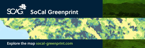
SoCal Greenprint is a web-based mapping tool to help local jurisdictions, transportation agencies, stakeholders, and local communities make strategic land use and infrastructure decisions, support conservation investments, and offset the impacts of transportation and development projects.
This optional, flexible, open data tool maps high-quality environmental, ecological, and land use data to support regional advance mitigation planning initiatives. It also assists local and subregional agencies in securing state and federal funding for sustainability and resilience projects and programs in the SCAG region.
By offering credible, centralized data for grant applications and project justification, the SoCal Greenprint empowers communities across the SCAG region to pursue impactful, future‑focused investments.
The SoCal Greenprint is part of SCAG’s broader RAMP initiative, required by the Connect SoCal Regional Transportation Plan/Sustainable Communities Strategy for both 2020 and 2024—as well as their program environmental impact reports—to support regional advance mitigation programs.
In February 2024, the SCAG Regional Council approved data standards to ensure the SoCal Greenprint tool meets its objectives, aligns with the Regional Advanced Mitigation Program Policy Framework, and accounts for feedback from the Greenprint Technical Advisory Committee. The data standards also ensure the tool’s data are consistent and trustworthy, with clearly defined rules for use, access, distribution, and security.
Request Access to the SoCal Greenprint
To access the SoCal Greenprint, users will need to create an Arup account as part of the onboarding process. Please email your first and last name to SupportSCAGGreenprint@arup.com to request an account.
Already have a SoCal Greenprint account with Arup? Visit the Arup website to log in and access the tool. Arup also published a user guide for additional information on how to access and use the tool.
RAMP Policy Framework
The RAMP Policy Framework, adopted by the Regional Council in February 2023, provides background on Connect SoCal’s goals and Program Environmental Impact Report requirements related to RAMP, outlines goals for regional advance mitigation and SCAG’s RAMP Initiative, and guides the development of the SoCal Greenprint tool to provide data that aligns with advanced mitigation opportunities.

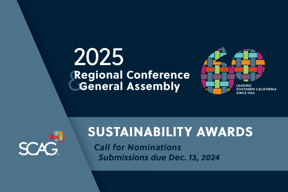
The SCAG Sustainability Awards recognize projects for outstanding contributions to the local implementation of the Connect SoCal, SCAG's Regional Transportation Plan/Sustainable Communities Strategy for a more mobile, sustainable, and prosperous region.
CONTACT
For more information on the SCAG Sustainability Awards, please contact: contactus@scag.ca.gov.
- OUSTANDING ACHIEVEMENT AWARD IN SUSTAINABILITY
City of Riverside Vehicle Miles Traveled Mitigation Bank Pilot Program
City of RiversideThe city of Riverside’s Vehicle Miles Traveled (VMT) Mitigation Bank Pilot Program is an innovative, first-in-county initiative that provides developers with a streamlined, low-cost option to fully mitigate VMT impacts under the California Environmental Quality Act (CEQA), at the lowest known statewide rate of $98 per VMT reduced. The program offers cost certainty and faster entitlements while generating a dedicated funding source to deliver citywide infrastructure projects that improve safety, reduce emissions, and expand multimodal access—which has funded 16 such projects so far. Developed through extensive stakeholder and community engagement, the program also modernized the city’s CEQA thresholds, traffic impact guidelines, and introduced the TREDLite tool to expedite VMT analysis and decision-making.
- MOBILITY
Active and Clean Mobility
Coachella Valley Link (CV Link)
Coachella Valley Association of GovernmentsImage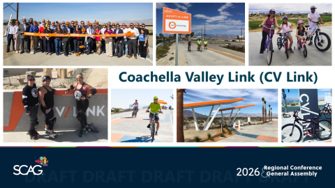
CV Link is a first-of-its-kind, 40-mile, multi-jurisdictional active transportation corridor providing a safe pathway, separated from vehicle traffic, for walking, biking, and low-speed electric vehicles across the Coachella Valley. Completed in 2025, the project connects residents and visitors to jobs, schools, services, and destinations while delivering measurable benefits in mobility, public health, air quality, equity, and economic vitality, particularly for disadvantaged communities.
Transportation Innovation
Experience Metrolink
San Bernardino County Transportation Authority, Metrolink, Riverside County Transportation CommissionImage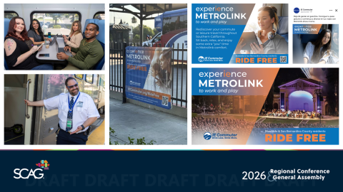
Experience Metrolink is a fare-free, technology-enabled rail incentive program led by the Riverside County Transportation Commission and the San Bernardino County Transportation Authority in partnership with Metrolink and IE Commuter. By providing up to 90 days of free Metrolink travel, the program lowers cost barriers to encourage lasting mode shift to rail and expands equitable access to jobs and services.
- COMMUNITIES
Great Places
Cottage Industries – Farm Block
City of Garden GroveImage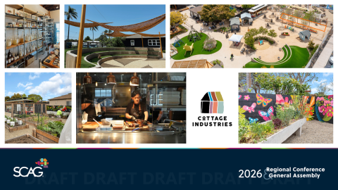
The Farm Block is an adaptive reuse and placemaking project in Garden Grove that transforms six historic homes and underutilized parcels into a walkable, mixed-use community destination centered on local food, small businesses, and urban agriculture. Delivered through a public-private partnership with Cottage Industries, the project provides affordable commercial space, a half-acre community garden, and vibrant public gathering areas.
Housing for Sustainability
Housing Accessibility Initiative
City of LancasterImage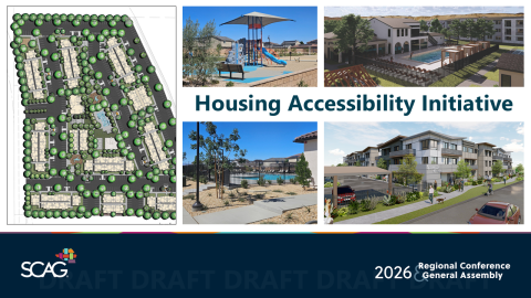
The Housing Accessibility Initiative (HAI) is the city of Lancaster’s comprehensive strategy to rapidly expand diverse, high-quality housing options and meet 6th Cycle Regional Housing Needs Assessment obligations. The HAI enables unprecedented housing production across market-rate, affordable, special-needs, senior, and accessory dwelling unit-integrated projects.
- ENVIRONMENT
Adaptation and Resilience
Regional Community Wildfire Protection Plan for the San Gabriel Valley
San Gabriel Valley Council of GovernmentsImage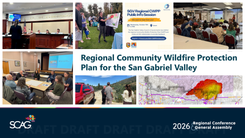
The Regional Community Wildfire Protection Plan (CWPP) for the San Gabriel Valley is a comprehensive, science-based framework that coordinates wildfire preparedness, mitigation, response, and recovery across jurisdictions affected by the recent Bobcat, Bridge, and Eaton fires. The CWPP integrates advanced hazard and social vulnerability analyses to prioritize life safety, protect critical infrastructure, and support nature-based and built-environment resilience.
Climate Leadership
From Plan to Action: Pico Rivera Climate Action and Adaptation Plan (CAAP) Adoption and Early Implementation
City of Pico RiveraImage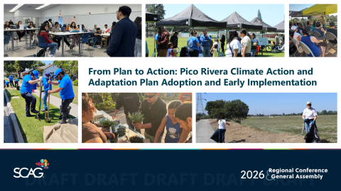
Adopted in January 2025, Pico Rivera’s Climate Action and Adaptation Plan (CAAP) establishes an implementation-focused framework to cut greenhouse gas emissions, improve public health, and build climate resilience, with a goal of carbon neutrality by 2045. The CAAP prioritizes near-term, community-scale actions in electricity, transportation, and waste.
- ECONOMY
Economic Resilience
Calexico East Port of Entry Bridge Widening Project
Imperial County Transportation CommissionImage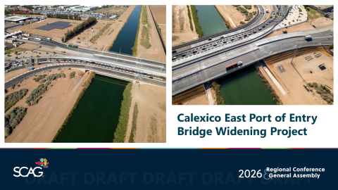
The Calexico East Port of Entry Bridge Widening Project eliminated a longstanding bottleneck at this commercial freight corridor, strengthening the efficiency and competitiveness of California's freight system while supporting trade flows essential to both U.S. and Mexican economies. For Imperial County residents, the project delivers measurable quality-of-life improvements: reduced exposure to harmful vehicle emissions, safer pedestrian crossings, and reliable access to cross-border employment and services.
- CARMEN REMIREZ AWARD FOR EQUITY
Safe Travels in Nyeland Acres
Nyeland Promise, Oxnard Ventura CountyImage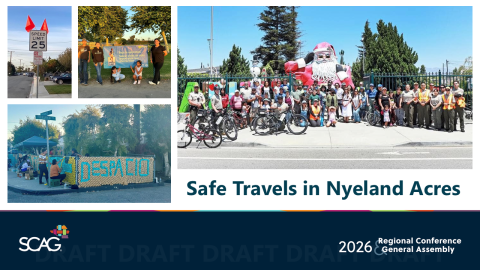
Nyeland Promise is a community-rooted nonprofit advancing equity, safety, and quality of life in Nyeland Acres through multilingual, resident-led planning and advocacy. The organization delivers people-first initiatives—such as Safe Travels in Nyeland Acres—that improve active transportation, traffic safety, and environmental health for vulnerable populations while elevating community voice.
Award Categories
SCAG accepts Sustainability Awards submissions in nine categories. Applicants can submit their nominations under only one category. Each year, the SCAG selects a standout project from all nominations to receive the Outstanding Achievement in Sustainability Award.
- Mobility
Active and Clean Mobility
Honors a project, program, plan, or policy that expands opportunities for biking, walking, rolling, and other clean or micro-mobility modes, including electric vehicles. Projects should illustrate how they improve safety, connectivity, and access while encouraging a shift toward active and zero-emission transportation for a more sustainable and connected region. This category recognizes efforts that reduce vehicle miles traveled, support first- and last-mile connections, and integrate active and clean mobility options into broader community and transportation networks. Projects may also demonstrate collaboration across agencies, jurisdictions, or sectors to advance multimodal mobility and equitable access to transportation choices.
Transportation Innovation
Honors a project, program, plan, or policy that applies creative or technology-driven solutions to enhance mobility, reduce emissions, and improve safety. Projects should demonstrate innovative approaches such as transportation demand management (TDM), systems integration, data-informed decision making, or new infrastructure and mobility strategies that advance a smarter and more efficient transportation network. This category highlights efforts that use innovation to optimize transportation systems, improve user experience, and deliver measurable sustainability benefits. Projects may also showcase collaboration across agencies, private partners, or technology providers to pilot new solutions, scale successful practices, or reimagine how people and goods move throughout the region.
- Communities
Great Places
Honors a project, program, plan, or policy that creates or supports vibrant, complete communities and sustainable public spaces. The award recognizes efforts that enhance the public realm, promote placemaking, and strengthen local identity through thoughtful design, community engagement, and equitable access. Projects should demonstrate how they improve livability, walkability, and connectivity while fostering social interaction and environmental stewardship. This category highlights transformative public spaces (e.g. plazas, corridors, parks, and mobility hubs) that integrate transportation, housing, and open space to create enduring and inclusive community destinations. Projects may also showcase innovative design, adaptive reuse, or collaborative partnerships that contribute to a more connected and resilient region.
Housing for Sustainability
Honors a project, program, plan, or policy that advances sustainable and equitable housing through increased production, affordability, or access. The award recognizes efforts that support transit-oriented development, streamlined approvals, enhanced housing resilience, inclusive growth in high-opportunity areas, and other related initiatives. Projects should demonstrate how housing strategies contribute to reduced greenhouse gas emissions, improved access to jobs and other key destinations, and more complete, connected communities. This category highlights innovative approaches that integrate housing with transportation and land use planning, promote resource-efficient building practices, and foster long-term affordability and climate resilience. Projects may also showcase partnerships between jurisdictions, developers, and community organizations to deliver equitable, sustainable housing solutions across the region.
- Environment
Adaptation and Resilience
Honors a project, program, plan, or policy that strengthens community resilience and prepares the region for climate-related hazards such as drought, wildfire, flooding, sea level rise, or extreme heat. The award recognizes proactive approaches that reduce risk, protect lives and livelihoods, and safeguard critical infrastructure, natural resources, and ecosystems. Projects should demonstrate how adaptation strategies enhance long-term sustainability, equity, and public health while supporting regional coordination and community capacity-building. This category highlights innovative and collaborative solutions (e.g. resilient infrastructure, nature-based strategies, and community-driven planning) that help Southern California adapt to a changing climate and thrive amid future challenges.
Climate Leadership
Honors a project, program, plan, or policy that demonstrates exceptional leadership in reducing greenhouse gas emissions or sequestering carbon through clean energy, efficient buildings, low-carbon land use, green infrastructure, or zero-emission transportation. The award recognizes efforts that advance regional climate goals and contribute toward carbon neutrality while promoting community resilience and environmental stewardship. Projects should illustrate progress in emissions reduction, energy efficiency, or adaptation, and demonstrate collaboration across sectors to address the challenges of reducing emissions. This category highlights forward-thinking approaches that integrate innovation, equity, and sustainability to build a cleaner, healthier, and more climate resilience in Southern California
- Economy
Community Funding and Finance
Honors a project, program, plan, or policy that mobilizes funding or financing strategies to deliver community investments that support economic development and long-term sustainability. Investments may include transportation, housing, green infrastructure, utility systems, or natural and working lands. The award recognizes innovative financial tools, partnerships, and resource-alignment strategies that help communities implement transformative projects. Projects should demonstrate how funding approaches advance equitable growth, leverage diverse funding sources, and maximize the impact of public and private investment. This category highlights initiatives that strengthen local economic foundations while achieving lasting social, environmental, and fiscal benefits across the region.
Economic Resilience
Honors a project, program, plan, or policy that strengthens local and regional economies and promotes long-term prosperity. The award recognizes initiatives that diversify economic opportunities, build workforce capacity, support small businesses, and enhance the region’s ability to adapt and thrive amid economic and environmental change. Projects should demonstrate strategies that foster inclusive growth, create quality jobs, and align economic development with sustainability and equity goals. This category highlights efforts that leverage innovation, partnerships, and community investment to build a more resilient, competitive, and equitable regional economy.
- CARMEN RAMIREZ AWARD FOR EQUITY
Honors a project, program, plan, policy, or collaboration that advances equity and fosters the growth of healthy, livable, sustainable, and economically resilient communities. The award recognizes efforts that meaningfully improve outcomes for traditionally marginalized, vulnerable, or underrepresented populations. Projects should demonstrate how equity principles are embedded throughout planning, engagement, and implementation that ensure community voices help shape decisions and outcomes. This category highlights initiatives that remove systemic barriers, expand opportunity, and promote environmental and social justice through inclusive and collaborative approaches that strengthen the region’s shared prosperity and sustainability.
Drought, extreme heat, wildfires, earthquakes, and other natural threats have been a reality for the SCAG region and California throughout history. The accelerating frequency of these events challenges Southern California’s overall resilience and ability to adapt. Effective emergency response to large wildfires, for example, requires enhanced coordination between multiple agencies and local jurisdictions. Climate change also negatively affects air quality, drives sea-level rise and coastal and inland flooding, stresses our infrastructure and utility systems, and strains our water supply, among other impacts. These are regional issues that require local and regional coordination. SCAG’s Connect SoCal Regional Transportation/Sustainable Communities Strategy identifies a vision and strategies to guide the region to meet the demand for key needs such as housing while increasing regional resilience.
The Southern California Clean Cities Coalition is a U.S. Department of Energy (U.S. DOE) designated coalition in the Clean Cities and Communities partnership. The mission of the U.S. DOE’s Clean Cities and Communities partnership is to advance the nation’s economic, environmental, and energy security by supporting local decisions to adopt practices that reduce petroleum consumption.
Regional advance mitigation planning (RAMP) enables state and federal agencies to simultaneously consider the environmental impacts and mitigation needs of multiple planned projects and to satisfy mitigation requirements early in project planning and environmental review. RAMP improves certainty, accelerates project delivery, and lowers permitting costs. It also helps agencies to consider species and habitat needs at a landscape level, preserving larger areas of high-quality habitat and improving regional ecological function.
The SCAG Sustainability Awards recognize projects for contributing to the goals of the Connect SoCal Regional Transportation Plan/Sustainable Communities Strategy and for achieving progress toward a more mobile, sustainable, and prosperous region.
CONTACT
For questions regarding the 2024 SCAG Sustainability Awards, please contact:
Lyle Janicek
janicek@scag.ca.gov